Bringing UAS Traffic Management Down To Earth

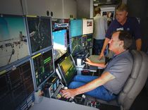
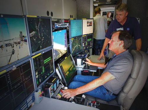
SITUATIONAL AWARENESS: One of the key aspects of UAS traffic management is providing pilots and operators with information that makes them aware of changing conditions as they fly. / PHOTO: NASA

November 20, 2023

BY Patrick C. Miller

As Parimal Kopardekar lists the five basic principles guiding the development of a traffic management system that will handle the millions of unmanned aircraft expected to be in U.S. skies in the next few years, the problem doesn’t appear complex. 

First, he says drones shouldn’t collide with each other. Second, they must keep a safe distance from manned aircraft. Third, their pilots should be aware of the rules governing the airspace in which they’re operating. Fourth, unmanned aerial system (UAS) operations must defer to public safety. Finally, there must be a way to positively identify every drone. 

However, bringing these elements together to develop a UAS traffic management system that suits the needs of hobbyists while enabling businesses and other organizations to take advantage of the technology’s tremendous potential is likely years away. 

Kopardekar—or PK as he’s known—has become the face of UAS traffic management. He serves as manager of NASA’s Safe Autonomous System Operations Project based at the agency’s Ames Research Center at Moffett Field south of San Francisco. He’s also the principal investigator of NASA’s UAS traffic management (UTM) program, the highway in the sky where everyone from hobbyists to commercial UAS operators must find a way to safely coexist, as well as helicopters and crop dusters that routinely fly in the airspace below 500 feet.

As Kopardekar readily admits, designing and developing the UTM system is not without its challenges. 

“If you’re going to do deliveries all the way to the doorstep—what we characterize as the last 50 feet problem—then you need software and hardware that collectively works together when all of a sudden there’s wind, a fallen tree branch or kids playing soccer,” he explains. “You want that onboard capability that decides whether to land, abort or go somewhere else. These are the key technology pieces we need. Plus, we need a better prediction of weather and wind at lower altitudes in airspace.”

Another challenge is providing critical information on a timely basis to UAS operators to improve their situational awareness. This not only lets pilots of manned and unmanned aircraft know where they’re operating in relation to each other, but also provides them with changes in the weather or lets them know when the FAA issues temporary flight restrictions.

Connecting Manned Protocals to UAS Flights 
Mike Glasgow, chief architect of Lockheed Martin Flight Services, is working to move the briefing system that’s worked well for general aviation (GA) pilots into the UAS age. This means changing the way UAS pilots flying under FAA Certificates of Authorization (COAs) file Notice To the Airmen (NOTAMs) over the phone to alert others about their operations, as well as the way Flight Services briefs pilots. 

“In today’s environment, not everyone can just go fly,” Glasgow says. “Handling the current volume is not too much of a problem, but looking into the future, we were concerned that a telephone-based model to report your operations does not scale.”

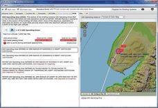
Lockheed Martin has created a web-based system through which UAS operators can file NOTAMs online that then show up as UAS operating areas (UOAs) on a national map at www.1800wxbrief.com, the Flight Service pilot briefing website. It shows pilots where all the known UAS operations are being conducted on UOAs filed on the website or submitted via NOTAM.

“Right now, all the UAS support is integrated in with the GA pilot capabilities,” Glasgow says. “At some point we may stand up an additional website that is just the UAS capability so that the operator who’s not a pilot doesn’t have so much stuff around them that they don’t really understand.”

Kopardekar says that for now with only a few thousand Section 333 exemptions issued by the Federal Aviation Administration for commercial UAS purposes and no beyond visual line-of-sight operations allowed, traffic management isn’t an urgent need. 

“Regardless of whether you’re driving an autonomous car or driving the car yourself, you still need rules and traffic lights. You need some way to organize the traffic when the demand exceeds capacity,” he says. 

NASA’s UTM won’t resemble the fixed system used for auto traffic and it won’t be similar to that of manned aviation, according to Kopardekar. 

“What we are doing is digital, versatile and flexible; it’s on-demand capacity,” he explains.

While the FAA is the government agency most often identified with the safe integration of UAS into the national airspace, NASA is playing a lead role in developing the system that will be needed to handle commercial and recreational UAS traffic in the Class G airspace below 500 feet.

Advertisement

“The first A in NASA is aeronautics,” says Kopardekar. “We have been doing air traffic management, related research and development for over two decades.”

In addition to working with the FAA, the Department of Homeland Security, the Department of Defense, the Department of Interior and the National Oceanic and Atmospheric Administration, NASA has more than 125 collaborators in industry and academia assisting in the development of UTM.

“NASA is a really good interface in that they are the government, but they’re not the FAA,” says Jonathan Evans, CEO of Skyward, a company based in Portland, Oregon, developing its Urban Skyways Project in partnership with NASA. “They’re capable of promulgating technical standards to the wider industry at the pace it needs to happen.”

Kopardekar believes that because the project deals with national and regional security, safe airspace integration and scalable operations for economic growth, the number of external partners involved is warranted. 

“We need to make sure we take into account all the use cases and all the different variations of technology out there—sensors, 3D maps, ADSB and tracking,” he says. “It’s working out as we had envisioned or even better. People really like the construct of coming to NASA UTM to collaborate with each other and accelerate these sort of things.”

The UTM system being developed by NASA is designed to increase or decrease the requirements on a UAS and its operator depending on the type of application being performed, the location of the flight, the capability of the aircraft and the airspace requirements. In other words, a drone delivering a package in a congested urban area will have more operational requirements than a drone flying a precision agriculture mission in a remote rural location. 

“The elegance of it is very dynamic and as needed,” Kopardekar explains. “There’s flexibility where possible and structure where necessary. You only offer structures when you need to. The system is intelligent enough to bring those structures in.”

Unveiling UTM  
The NASA UTM system will be rolled out in four builds, the first of which was tested in August and involved approximately 100 flights in low-traffic, low-density airspace with 11 collaborators. Among the technologies tested was a cloud-based system that showed where UAS trajectories overlapped and created new flight paths to avoid collisions. 

“We learned lots of good things doing this in the national airspace—how the system could evolve, how the system could work and what kind of challenges we see,” Kopardekar notes. 

The test for Build 2 is scheduled for October 2016 and will involve beyond visual line-of-sight applications to study tracking and establish procedures and “rules of the road” for UAS operations over sparsely populated areas. Kopardekar describes the Build 1 test as a stepping stone toward Build 2. 

“Beyond visual line-of-sight has its own challenges,” he says. “Some capabilities on the vehicle need to be in place to be more autonomous.” 

The Build 3 tests are set for January 2018 and will test beyond line-of-sight operations over moderately populated areas, interaction between manned and unmanned aircraft, UAS tracking and various communications options. Build 4 in March 2019 will test beyond visual line-of-sight operations in urban environments, autonomous operations and such applications as news gathering, deliveries and personal use.

At the UTM Conference sponsored by NASA last July, Amazon and Google presented competing ideas on how low-altitude UAS traffic management should be handled to accommodate the companies’ plans for package delivery via drone. Both companies advocated airspace dedicated to certain uses. 

Fabrice Kunzi, who participated in the convention and is the chief technical officer for Panoptes UAV, is concerned that such approaches will result in UAS segregation rather that than integration into airspace in which manned aircraft operate. 

“There’s definitely two worlds here and I think a lot of people are starting to pick up on that,” he explains. “By definition, it’s not integration because we say everybody above 500 feet stays out and everybody below 500 stays in. We’re segregating traffic in order to manage it. That’s different from airspace integration, which is what a lot of people are advocating.”

He has other concerns about the UTM approaches advocated by the retail giants. 

Advertisement

“One thing that both of them just kind of glossed over is that it’s easy to do traffic management if everybody’s cooperative and is telling you who they are, where they are and where they’re going,” Kunzi says. “But you can’t assume that everybody is cooperative.”

While he agrees that Goolgle’s idea of using cell phone networks for UAS navigation has merit, Kunzi questions their reliability for autonomous beyond visual line-of-sight operations. 

“Cell phone-based technology isn’t nearly as reliable as the technology that we find at the front end of an airplane,” he says. “If you’re going to use it as a means to provide safety in the national airspace system or a low-altitude environment, the level of reliability that you need the cell phone system to provide is not the level of reliability that the system was originally designed to support.”

Another UTM challenge revolves around presenting information to UAS pilots and operators who might have little or no experience in manned aviation. 

“It’s great to know where you’re going before you fly, but it’s better to know what’s going on as you fly,” says Shaun Muehler, a former military pilot and the CEO of Botlink, a company in Fargo, North Dakota, developing an application that serves as the interface with the drone operator.

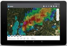
“It can’t just be a map that you log into and see where you’re going to fly and see what airspace is around it and who controls it,” Muehler explains. “It has to be interactive with the pilot as he’s flying, as he’s working his drone and his workflow. He’s got to get alerts and he’s got to get notified as his drone is in the air.”

Lockheed Martin allows UAS software developers to integrate its flight briefing information into programs and applications that UAS pilots and operators use to manage their flight operations. 

One of the first UAS flight management programs to integrate Flight Services information was VirtualAirBoss developed by SmartC2 headquartered in Grand Forks, North Dakota.

“Some people focus on putting the UTM in the aircraft,” says Stuart Rudolph, SmartC2 CEO. “We focus on it as being able to schedule flights, making plans beforehand and saying where we’re going to fly.”

For example, Rudolph says VirtualAirBoss demonstrated its ability to integrate with NASA’s UTM last June during the annual Coastal Trident exercise off the coast of southern California, a field exercise involving state, local and federal agencies responding to simulated regional threats and emergencies. The program was used to help manage the airspace for UAS. 

Mariah Scott, chief operating officer for Skyward, emphasizes that even without a mature, comprehensive national traffic management system in place for UAS, the present system enables businesses that want to take advantage of the technology to operate commercially today. 

“Traffic management is often thought of as something in the future that has to happen for package delivery, but actually safe integration of UAS into the airspace and managing that airspace is happening right now,” she says. “That’s the service that we’re providing for commercial operators.

“In the long term, package delivery and really sophisticated route planning and traffic management is coming,” she continues. “But right now, we’re already seeing systems to manage the airspace and to safely integrate UAS.”

In discussing the need for UTM, Kopardekar and Glasgow each invoked an event from 1956 when two airliners collided in midair over the Grand Canyon, killing 128 people on board. At the time, it was thought that there was little need for air traffic control over remote areas. The accident provided the incentive to create the FAA.

“I think all of us live in fear of that kind of moment happening again with a UAS,” Glasgow notes. “It’s not a good thought.”

Kopardekar concurs and adds, “We wanted to make sure that we have some system in place so that we don’t repeat history. That’s the impetus behind this research initiative.”

Author: Patrick C. Miller 
Staff Writer, UAS Magazine 
pmiller@bbiinternational.com 
701-738-4923

Upcoming Events

Sign up for our e-newsletter!

Advertisement

Advertisement